)
UNAVCO Trimble 5700/R7 Campaign Kit
UNAVCO Trimble 5700/R7 Campaign Kit
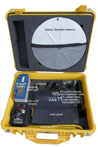
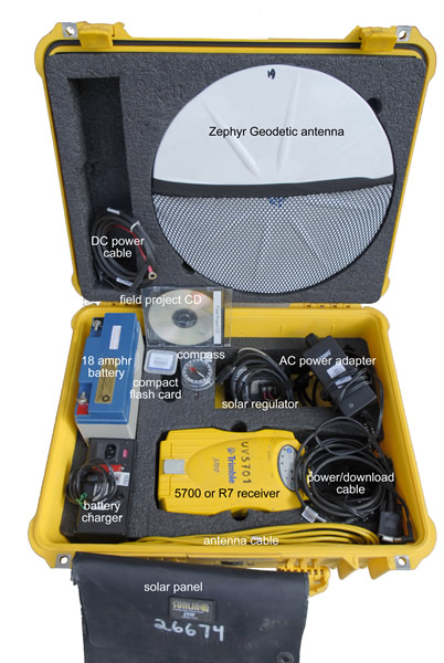
The Trimble 5700/R7 campaign GPS kit is UNAVCO’s most commonly-used campaign kit. The 5700/R7 receiver is lightweight, low power, can run off internal batteries, logs data to a removable compact flash card, and can hook onto a range pole if desired. It is ideal for campaign and kinematic surveys and is also usable for long-term/permanent sites. 5700s and R7s require Trimble software running on Windows for programming; there is no display. Lights indicate receiver status. ANTENNA MONUMENTATION AND MOUNTS MUST BE REQUESTED SEPARATELY. See "Additional Resources" at the bottom of the page.
Components
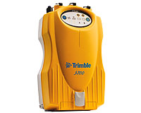
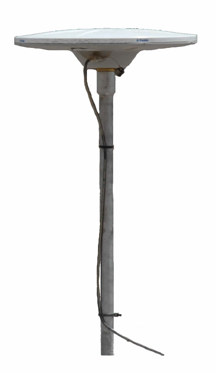
5700 or R7 receiver, Trimble - Records GPS data received via the antenna.
Trimble R7/5700 Resource Page (includes e.g. software, firmware, and how-tos)
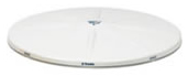
Zephyr Geodetic antenna, Trimble - Receives GPS data and transmits data to the receiver.
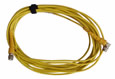
antenna cable (10 m TNC-TNC) - Transmits the data from the antenna to the receiver. Connect the 90-degree connector (if there is one) to the antenna and the straight connector to the receiver. Do not kink the cable; when coiling the cable, do not coil it around your hand and elbow.
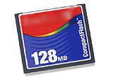
compact flash card - 128-512 MB based on availability; request a 512 MB card if you have large memory requirements. At a rate of 15 s data collection, approximately 3 months of data can be stored on a 128 MB card.
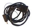
power/download cable - Used to connect the receiver to a computer and/or in conjunction with the AC power adapter connect the receiver to AC (outlet) power. Connect this cable to a computer (you may have to use a USB-to-serial adapter if your computer does not have a serial port), to the AC power adapter, and to port 2 or 3 of the receiver.
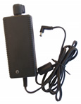
AC power adapter - Used in conjunction with the power/download cable to connect the receiver to AC (outlet) power. Connect this cable to a power outlet and to the power/download cable.
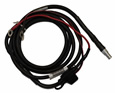
DC power cable - Used to connect the receiver to DC (battery) power. Connect this cable to the battery terminals (red wire to red/positive terminal, black wire to black/negative terminal) and to port 2 or 3 of the receiver.
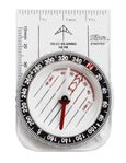
compass - Used to align the GPS antenna to true north.
How to use declination to align the GNSS antenna to true north
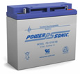
18 amp hr battery (12 volts) - Will power the receiver and GPS antenna for approximately 2 days in optimal conditions. Battery life decreases significantly in cold weather. Do not allow conductive material (e.g. a piece of metal) to contact both terminals at the same time as this will short the battery.
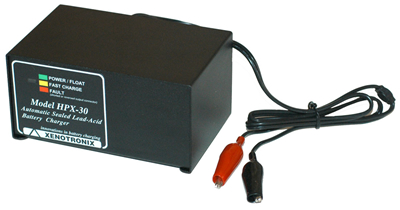
battery charger - Will completely recharge a battery at 11 volts (the shut-off voltage for the receiver) in several hours. Make sure the switch on the back is showing the appropriate voltage for your region (e.g. 120 volts in US, 240 in most of Europe). If the battery charger fails, check this switch and change the fuse as needed. Connect the cable to the battery terminals (red alligator clip (connector) to the red/positive terminal and black clip to the black/negative terminal). Do not allow the connectors to touch each other when the charger is plugged in.
solar panel - Charges the battery when there is sufficient sunlight. Will maintain a 12+ volt charge on the battery. With 12 hours of daylight, the 18 amp hr battery and the solar panel should provide a sustainable power source for an extended period of time (weeks to years).
solar regulator - Regulates the power from the solar panel to the battery. Connect the incoming cable to the solar panel and the outgoing cable to the battery terminals (red connector to red/positive terminal, black connector to black/negative terminal).
Additional Resources
UNAVCO Resources: GNSS Station Monumentation
Geodetic monuments and markers; this is principally a resource for permanent station monumentation but includes campaign options as well.
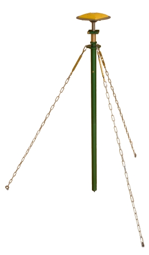
UNAVCO Resources: GNSS Antenna Mounts
An antenna mount is used to couple the GPS/GNSS antenna to the survey point. Different mounts are appropriate for different survey types.
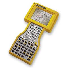
UNAVCO Resources: GPS Survey Controllers
Survey controllers can be used to incorporate metadata into a GPS survey and are commonly used for real-time kinematic, post-processing kinematic, and fast/rapid-static surveys.