)
UNAVCO Summary of Optech ILRIS-3D
Retired October, 2012. No longer owned by UNAVCO
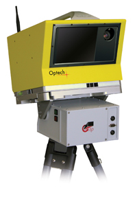
The ILRIS is a long range scanner (up to ~1500 m) and was UNAVCO’s first TLS instrument, acquired in 2008. We specially outfitted this scanner for cold weather deployment and it was a tried and true instrument for polar applications. It was deployed in non polar environments as well.
The ILRIS is a long range scanner (up to ~1500 m) and was UNAVCO’s first TLS instrument, acquired in 2008. We specially outfitted this scanner for cold weather deployment and it was a tried and true instrument for polar applications. It was deployed in non polar environments as well.
| Back to TLS Comparison Table |
TLS System |
Min. Range |
Max. Range |
Repeatability |
Power Draw |
Field of View |
Weight |
Operating Temp |
|
|
Optech ILRIS-3D |
3 m |
1,500 m |
7 mm | 75 W | 40° x 40° | 13 kg / 28.7 lbs | -25°C - 40° C |
Optech Resources
Technical Specs and Manual
- Optech ILRIS website
- ILRIS-3D Technical Specs (pdf) - Technical specifications for the ILRIS-3D.
- ILRIS-3D Operation Manual (pdf) - Covers topics such as basic set-up, operation and maintenance of the Optech ILRIS 3D Terrestrial Laser Scanner LiDAR system.
Software Manuals
PolyWorks
- InnovMetric PolyWorks V10 Beginner’s Guide (pdf) - Contains the InnovMetric PolyWorks V10 Beginner’s Guide.
- TLS Manual - PolyWorks IMAlign v10 (pdf) - Shows the procedure to follow to align multiple scans into one point cloud.
- TLS Manual - PolyWorks Error Map (pdf) - By following these guidelines useres can create comparison maps or images to show differences in attributes within one scan (such as elevation differences).
Geo-referencing
- TLS Manual - Geo-referencing in IMINSPECT (pdf) - Instructions for geo-referencing in IMINSPECT.
- TLS Manual - Geo-referencing in PolyWorks IMAlign v9 (pdf) - Instructions for geo-referencing in IMAlign.
Matchview
- Matchview User Manual (pdf) - Explains to users how to align range data with a color digital camera image.
Calculating Pit Volume
- Calculating Pit Volume (pdf) - This document provides an example of how to calculate changes in volume by creating a mesh of the object or area in question.
Software and Calibrations
Software
- controller.exe
- controllerce.exe
- parser.zip