)
UNAVCO Resources: SAR Data and Services
UNAVCO Resources: SAR Data and Services
GeoEarthScope InSAR Archive
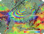
As part of Earthscope’s GeoEarthScope project, UNAVCO created an archive of SAR imagery, with data supplied by the European Space Agency (ESA; ERS1, ERS2, and Envisat missions) and the Alaska Satellite Facility (ERS1, ERS2 and Radarsat 1). This SAR data will aid research into earth deformation in North America caused by earthquakes, volcanoes, and other plate tectonic processes.
UNAVCO’s main tasks included placing, managing, and tracking data orders, working with ASF and ESA, and creation and operation of the data archives, web site, and online services.
For more information, go to the GeoEarthScope InSAR Archive home page.
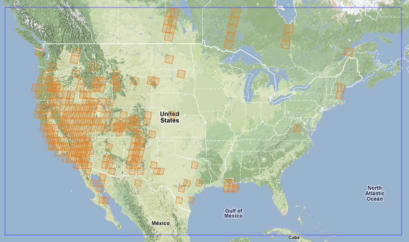
WInSAR SAR Archive
Western North American Interferometric Synthetic Aperture Radar Consortium (WInSAR) is a consortium of universities and research laboratories established by a group of practicing scientists and engineers to facilitate collaboration in, and advancement of, Earth science research using radar remote sensing. WInSAR helps coordinate requests for data acquisition and for data purchase, aiding individual investigators by simplifying interactions with data providers and with government agencies funding science, including NASA, NSF, and the USGS.
For more information, go to the UNAVCO WInSAR Home Page.
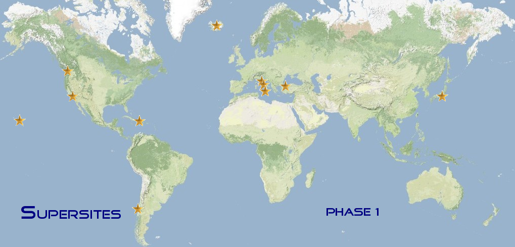
GEO Supersites
The Group on Earth Observations (GEO) Supersites have data for the study of natural hazards in geologically active regions, including information from Synthetic Aperture Radar (SAR), GPS crustal deformation measurements, and earthquakes. The data are provided in the spirit of GEO, ESA, NASA and the National Science Foundation (NSF), that easy access to Earth science data will promote their use and advance scientific research, ultimately leading to reduced loss of life from natural hazards.
For more information, go to the Group on Earth Observations Supersites page.
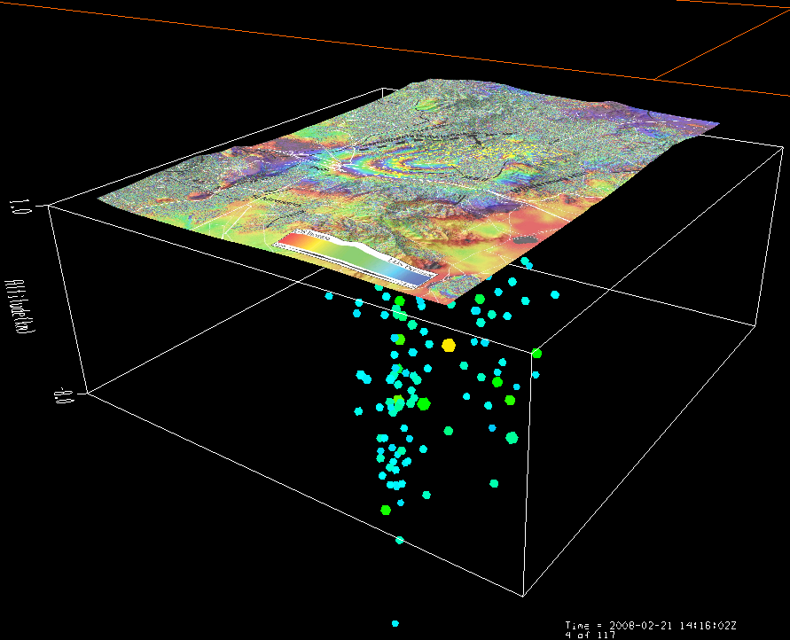
InSAR Images in the GEON IDV
The GEON Integrated Data Viewer (IDV) is a fully interactive, true 3D data display system for exploration of Earth-located data. The GEON IDV is ideal for exploration of complex three-dimensional data and allows comparison of multiple data sets and multiple data types, including InSAR images, in single displays.
For more information, go to The UNAVCO GEON IDV: InSAR images.