
Comparison of LiDAR Systems
Comparison of LiDAR Systems
|
System |
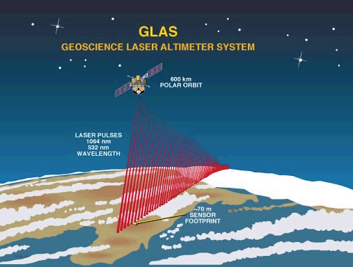
Spaceborne (e.g. GLAS) |
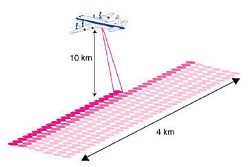
High Altitude (e.g. LVIS) |
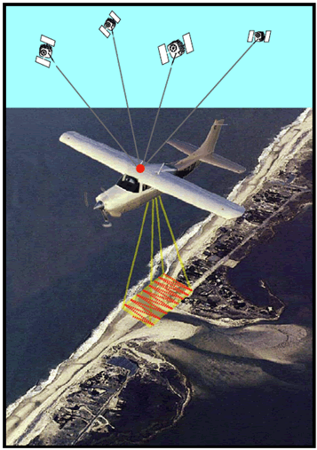
Airborne (ALS) |
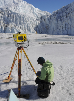
Terrestrial (TLS) |
|
Altitude |
600 km |
10 km |
1 km |
1 m |
|
Footprint |
60 m |
15 m |
25 cm |
1-10 cm |
|
Vertical Accuracy |
15 cm to 10 m (depends on slope) |
50/100 cm (bare ground / vegetation) |
20 cm |
1-10 cm (depends on range which is a few m.’s to 2 km or more) |