GPS Data Collection Methods
GPS Data Collection Methods
Various methods are used to collect high precision
differential GPS data. The particular method used depends on several
factors, including survey objectives, desired precision, available
equipment, and field logistics. Higher precision typically requires a
more rigorous field methodology and longer occupation times. The
following table shows the features of the most common GPS survey
methods:
|
|
Survey style
|
Typical accuracy
|
Occupation time
|
Typical applications
|
 |
Continuous
|
< 0.5 cm
|
Months or more
|
Crustal deformation, geophysics, reference stations
|
 |
Static
|
0.5 cm – 2.5 cm
|
Hours to days
|
Crustal deformation, geodetic control, very long baseline surveys, geophysics
|
 |
Rapid Static
|
1 cm – 3 cm
|
Minutes
|
Short baseline surveys, glaciology
|
 |
Kinematic (post-processing and real-time)
|
1 cm – 5 cm
|
Seconds
|
Short baselines, closely spaced points, vehicle positioning, feature surveys, GIS and mapping
|
(not supported)
|
Code Differential
|
50 cm – 300 cm
|
Seconds
|
Coarse GIS, mapping, positioning
|
(not supported)
|
Point positioning
|
100 cm – 500 cm
|
Minutes to hours
|
Rough positioning
|
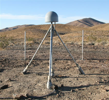
Continuous stations are continuously-operating long-term or permanent GNSS station installations involving immobile monumentation and sustainable power, and often involving data telemetry. The can be used as pre-existing base stations in campaign surveys (static, rapid static, and kinematic).
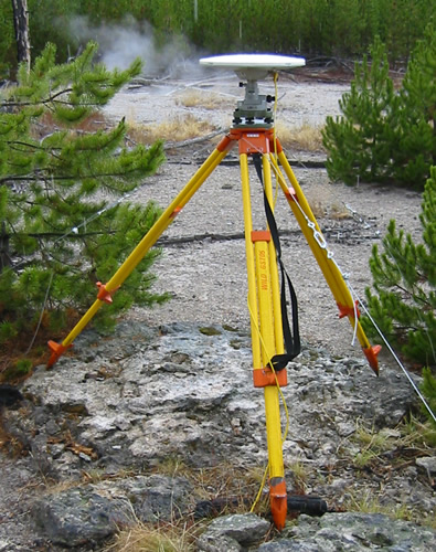
Static surveys are regional, sub-cm precision GNSS surveys with portable equipment and are
the standard campaign data collection method for crustal deformation
surveys. They typically involve occupying each point for several days to
get the highest possible accuracy. Collect at least 6 hours of simultaneous data per day for processing and repeat benchmark occupations if possible.
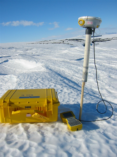
Rapid static surveys
are static surveys with just enough survey time at each point to be
able to resolve the carrier phase integer ambiguity. A rule of thumb is
to collect data for a minimum of 10 minutes per point, and add one
minute of occupation time per kilometer of baseline length over 10
kilometers. For example, on an eight-kilometer baseline collect at
least 10 minutes of data, and on a 28-kilometer baseline collect at
least 28 minutes of data.
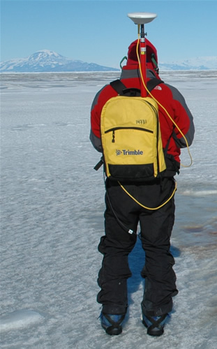
Kinematic surveys are local surveys (<10 km) using mobile GNSS equipment for the purpose of mapping features or of measuring point locations where several cm of precision is sufficient. At least two receiver set-ups are required: a base (stationary) unit and one or more rover (mobile) units. Kinematic surveys rely on continuous tracking to resolve the integer ambiguity; while the
rover receiver/antenna may be moving during the surveys, continuous lock
on the satellite signals must be maintained. Since the data processing
software is able to both resolve the ambiguity and track the antenna
motion, fixed-integer solutions are obtained nearly instantaneously.
Post-processing kinematic (PPK) refers to surveys without communication between the base and rover receivers. Processing the data after data collection is required. There are no navigational capabilities in PPK surveys.
Real-time kinematic (RTK) refers to surveys in which the base and rover receivers communicate corrections in real-time via a radio link. This requires additional hardware (base and rover radios) and additional power, and generally limits the survey to an area of several km, but eliminates the need for data processing and enables navigational capabilities.
Code differential
surveys rely only on the code data to determine a differential
solution. Simultaneous data collection between the base and rover
receiver is still required, but there is no requirement to maintain
continuous lock on the carrier phase since the phase data is not used.
As a result, this method is extremely robust, but relatively coarse.
For sub-meter accuracy, a rule of thumb is to collect data for five
minutes per point, and add one minute of occupation time per five
kilometers of baseline length over 10 kilometers. For example, on an
eight-kilometer baseline collect at least five minutes of data, and on
a 108-kilometer baseline collect at least 25 minutes of data.
Point positioning
uses only data from a single receiver to determine its coordinates. The
collected data are averaged, and longer occupations significantly
increase the accuracy. This method is very coarse, but sometimes it is
the only way to determine base station coordinates while in the field.
Although these coordinates may be off by about a meter, it is close
enough to allow the computation of precise baselines while at a remote
field location. When better network accuracy is desired, the base
coordinates must be re-computed when back from the field.
Article ID: 70
Created: February 25, 2010
Last Updated: February 25, 2010
Author: Freddy Blume
Online URL: https://kb.unavco.org/article/gps-data-collection-methods-70.html