| Back to comparison table |
Mount Commonly Used
|
Stability
|
Cost
|
Install Time
|
Labor
|
Substrate
|
Site Impact
|
 |
- | - | - | - | - | - | - |
Situations sometimes arise in which custom monumentation is required. UNAVCO works with researchers to design monumentation to fit project needs if the common monumentation solutions are insufficient. We try to keep custom monumentation simple and cost-effective. Some examples are given below. Right-click on an image and select "View Image" for a larger view.
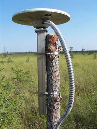
Site BLWC.
To measure deformation related to methane degassing of a peat bog in northern Minnesota, GPS antennas were mounted on trees in the bog. The trees are rooted in and move with the bog surface. For seven new sites in 2007, a tree within the area of interest was sawed off at a height of about 5 ft. The antenna was screwed onto a hollow square stainless steel pipe with a stainless steel plate and stainless steel 5/8" all-thread welded onto one end. A nut was tightened against the antenna to keep the antenna in place. The mount was fixed to the tree with hose clamps.
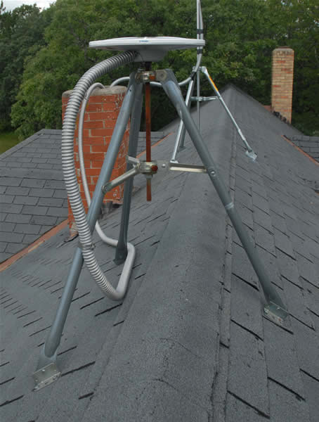
Site HATC.
Because there is no bedrock in the peatlands region, the base station antenna for the bog network in northern Minnesota was mounted on a roof. A simple commercial communications antenna mount was used.
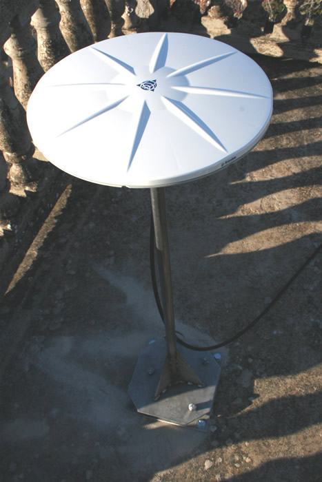
Site LUZZ.
In Luzzi, Italy, permission was obtained to install a GPS antenna on a church tower. However, the tower roof had a stone railing on which the antenna could not be installed directly because there was concern about visibility of the antenna from below. A stainless steel rooftop mount of an appropriate height (just tall enough to clear the railing) was designed with leveling capabilities built-in at its base.
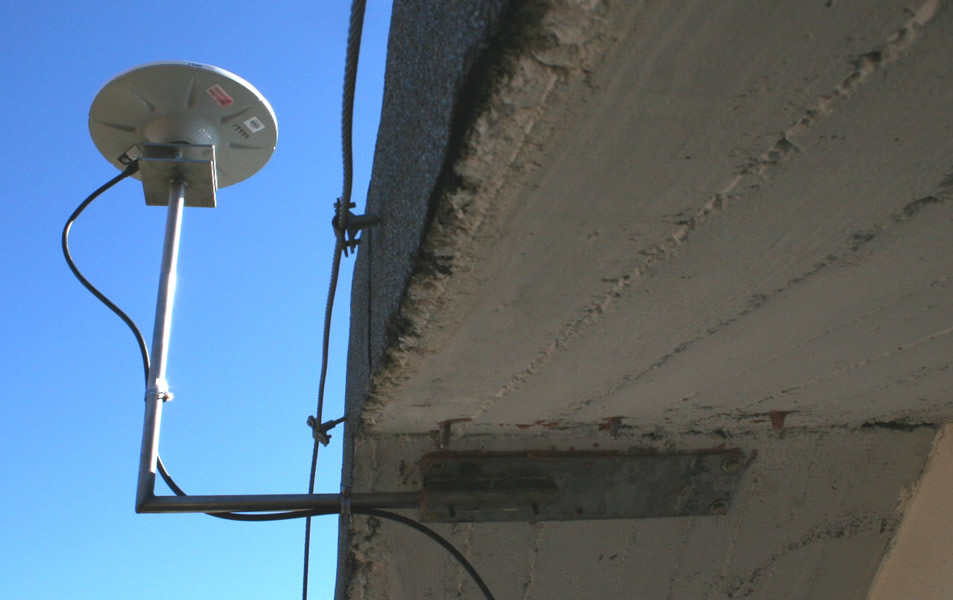
Site CRLM.
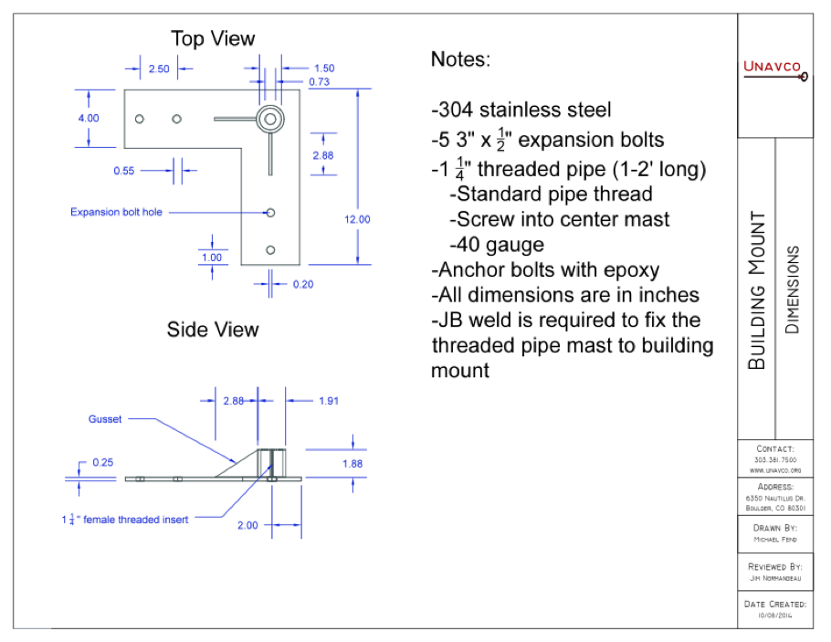
In Carlo Magno, Italy, heavy snowfall concerned building owners. UNAVCO designed a mount that would come out and up from the underside of the roof overhang to minimize build-up of snow on the GPS antenna. The mount consists of a plate bolted into the underside of the concrete roof with a pipe--including a 90 degree angle--secured to this plate. A leveling mount was welded to the top of the pipe. To accommodate an unknown roof angle, the pipe was designed to fit into a sleeve (hollow pipe) on the stainless steel plate; the pipe was rotated to vertical within the sleeve and set in place with set screws.
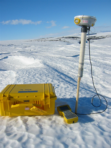
Measuring glacier velocities poses the challenge of establishing a marker accessible multiple years in ice, rather than in rock. In Antarctica, in regions of minimal snow accumulation, this can be accomplished by simple drilling a hole in the ice and inserting a bamboo pole, and then filling the rest of the hole with water which will freeze and fix the pole in place. The main challenge in the case of the Barne glacier, which is accessed by helicopter, then becomes making the markers visible from the air; tying bright orange flags onto the poles helps with this. Because glacier motion is fast (meters to hundreds of meters), a high-precision mount, alignment of the antenna to north, leveling the antenna, and a long survey are not needed; a fast-static survey (~20 minutes) using this PVC sleeve as a mount is sufficient to measure velocities.
Contact UNAVCO for more information on custom mounts and monumentation at support![]() unavco.org.
unavco.org.
Article ID: 328
Created: March 26, 2010
Last Updated: September 17, 2018
Author: Beth Bartel
Online URL: https://kb.unavco.org/article/unavco-custom-antenna-mounts-and-monumentation-328.html