Permanent GNSS/GPS Station Planning: Technology, Equipment, Costs
Permanent GNSS/GPS Station Planning: Technology, Equipment, Costs
Permanent GNSS Stations for Geodetic Applications: Equipment, Sites, Costs -- S. Fisher
This is intended as a primer for investigators wishing to implement permanent GNSS stations within their projects. A basic overview of equipment typically employed by UNAVCO investigators and site requirements is included, along with links to additional information contained on this and other web sites. We also include a summary of equipment sources and approximate costs to help with planning and budgeting of permanent stations.
For information or help, e-mail support![]() unavco.org.
unavco.org.
[+] Site Characteristics
Site Foundation
-
Local geology – consider proximity to faults, landslides, subsidence areas, etc.
-
Bedrock foundation is preferred
-
Soil or alluvium options require more extensive monumentation
-
Roof tops are sometimes the only option -- near support structures on bearing wall buildings is best, if roof top location is required
Horizon mask
-
Rule of thumb: minimize obstructions above 15°
Site security, ownership and permission
-
Location must be secure and viable over long term
Multipath
-
Rule of thumb: site should be at least 15 meters from reflective sources
-
Antenna height: at ground seems good, but observed multipath high at some sites with ~.5 m height
-
Avoid creating cavity between backplane and monument top
-
Researchers are working on methods for calibrating site multipath -- one example is the AMCS project
Radio Frequency Interference (RFI)
-
Rule of thumb: site should be at least 1 km from powerful microwave sources, independent of the frequency that they operate at
Co locations with other instrumentation
-
Co-location with VLBI or SLR systems is desired at core global reference stations
-
High precision tie survey essential, but is difficult and requires specialized knowledge and capabilities – contact support@unavco.org for more information
-
-
Site infrastructure (site location, power and communications) can be shared with nearby seismic stations
-
Requires coordination with operator such as IRIS
-
Data quality assessment can be accomplished using the UNAVCO TEQC toolkit
More Information on Site Reconnaissance and Security from the UNAVCO Knowledgebase
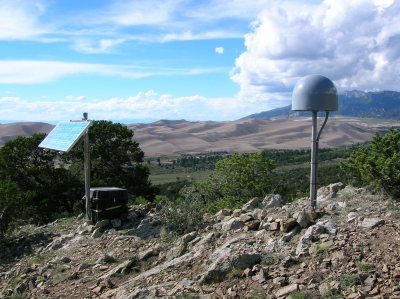
[+] Monuments
-
Short and deep drilled braced monuments are preferred by many
-
Pillars are easier to build and good under the right conditions – avoid top of pillar effects on GNSS signal from rebar or metal mounting plates embedded in the pillar
-
Reference marks and site/monument stability surveys are desired at core stations, such as IGS global stations
-
More information on monumentation from the UNAVCO Knowledgebase
[+] GNSS Receivers
Tracking Performance
-
General:
-
Dual frequency, many independent channels, up to 20Hz sampling, ~ 1 mm phase precision
-
-
GNSS observables
-
Current:
-
GPS L1 C/A, L1and L2 P, L1 and L2 phase (also under AS)
-
GLONASS L1 C/A Code, L1 P and L2 P, L1 and L2 phase
-
-
Coming soon:
-
GPS L2C, L5 – first launches in 2005-2007, IOC/FOC in 2012/2015
-
Galileo – IOC/FOC 2010+ (anticipated)
-
-
-
Performance measures
-
99%+ of expected data
-
Cycle slips/observations <0.1%
-
MP1 and MP2 <0.5 m at elev. >10°
-
Zero baseline phase precision < 1 mm
-
Short baseline precision 2 mm horizontal/4 mm vertical
-
Features and Specifications
-
Power consumption 3-10 W
-
Memory up to many GB
-
Multiple I/O ports
-
Log and output multiple formats simultaneously
-
Raw, RINEX, BINEX, RTCM SC104, etc.
-
-
Command and control interface
-
Built in server technology supports http and ftp over TCP
-
Configuration over network by uploading configuration file
-
Serial commands and custom interface applications
-
-
Environmental specifications: -40 to +60 C, humidity sealed
-
Power management: ability to cycle power remotely and automatic restart in same configuration after power loss
-
Ability to log and stream data from external sensors (met, tilt)
-
Code and carrier multipath rejection and ability to disable
-
External timing frequency input
-
Highly reliable: Mean Time Between Failure (MTBF) ~60,000 hours
Commonly Used Models
- Link to UNAVCO Member equipment purchasing information
- Link to UNAVCO receiver test reports
- More information on receivers available from UNAVCO
[+] Antennas
-
Stable, well defined phase pattern -- consistent between like models
-
Backplane that rejects multipath
-
Absolute calibrations of antenna and radome pair are now considered standard by IGS
-
Current best practice: Gold standard is still the choke ring design with D&M element, which is produced by several manufacturers, but many question whether extra cost is worth it and are going with less expensive models
[+] Antenna Mounts
-
Securely attach antenna to monument/tamper resistant
-
Ability to center, level and orient antenna in azimuth
-
Reduce potential for multipath by minimizing surface area (do not create resonant chamber behind antenna ground plane)
-
Current best practice: SCIGN mount or similar
[+] Radomes
-
Material should be homogeneous and of uniform dimension
-
Hemispherical shape with center of curvature at average (absolute) L1/L2 phase center Radome should be calibrated along with antenna
-
Current best practice: Do not use radome unless required for weather, debris or vandal protection
-
If used with a choke ring antenna, UNAVCO typically uses the SCIGN tall model
[+] Ancillary Sensors
-
Met – surface pressure and temperature at the GNSS antenna is required for water vapor applications
-
Tilt – site and monument stability, slope monitoring, volcano deformation
-
Data are typically logged within the GNSS receiver
[+] Power Systems
-
Power budget is typically 6-20 W, depending on receiver model and communications
-
Options include:
-
AC power with battery back up
-
DC with solar or wind generation systems
-
-
More information on power systems and lightning protection used by UNAVCO
[+] Enclosures
-
Securely house all station equipment
-
More information on equipment enclosures used by UNAVCO
[+] Data Communications
-
Communications solution depends on data requirement
-
Options range from analog modems over circuit switched (telephone) networks to broadband satellite
-
Use of public Internet is generally preferred
-
More information on data communications equipment used by UNAVCO
-
The following tables list data communications requirements for different GNSS applications and technology options to satisfy requirements
Definition of Data Communications Requirements for Different Applications |
|
|
Level 1:
|
|
|
Level 2:
|
|
|
Level 3:
|
|
|
Level 4:
|
|
|
Special:
|
|
Data Communications Technologies, Capabilities and Suitability of Use |
|||
| Service | Data Rate and Suitability | Approx. Cost (US) | Issues or comment |
| Broadband Internet | 128+ kbit/s All levels | $60 per month to much more, plus hardware, often access is provided at no cost by host institution | Limited availability of services outside of metropolitan areas, “last mile” problem, cost varies greatly by location and service level, some providers may charge by data volume, potential security and firewall issues |
| Dial-up/PPP | <56 kbit/s Level 1 | $30-200 per month, $100 hardware | Over phone network, limited bandwidth, potentially expensive telecom service fees, line quality can be problematic |
| Cellular Technologies (CDMA, CDPD, GSM) | 10-300 kbit/s Level 1-3 | $80 per month, $1,000 hardware for CDMA | Limited coverage (especially for data services), change management, network reliability and loading, no priority access for safety of life applications, PPP services in some areas |
| INMARSAT (BGAN and RBGAN) | 144-384 kbit/s Level 1-4 | Charged by byte, ~$150 per month for level 1-2, $1,500 hardware | New service, limited coverage as service rolls out, RBGAN has latencies, BGAN allows streamed data, but with very expensive per minute fees |
| IRIDIUM | <2.4 kbit/s Level 1-2 | $500/month at US government rate, commercial rates prohibitive, $1,500 hardware | Too expensive for all but the most remote locations where no other options exist, limited bandwidth, potentially useful for system health monitoring |
| Shared VSAT Service | 300-500 kbit/sLevel 1-4 | $200 per month, plus $1,000 hardware | Availability of local providers? System latencies may prohibit level 4 applications |
| Dedicated VSAT | 64-500 kbit/s Level 1-4 | $1,200 per month minimum space segment lease, $3,000 hardware plus hub | Licensing, expensive space segment lease, must own and maintain receiving hub, high power consumption, latencies my prohibit level 4 applications |
| Private Wireless | 115 kbit/s -54 mbit/s All levels Special | Costs vary substantially, WiFi - $300+, Industrial UHF - $2,000+, no airtime service fees | Addresses “last mile” problem, many options exist from WiFI to industrial narrowband, GPS vendors have proprietary solutions for RTK applications |
[+] Equipment Costs and Sources for PBO Style Permanent Stations
| Item | Approximate Cost |
P/N or Notes | Source |
|---|---|---|---|
| GNSS Receivers |
$3,400 to $12,000
|
Including antenna, Price depends on model and quantity ordered, PBO standard is Trimble NetRS with Choke Ring antenna | See UNAVCO Member Purchase Program for vendor contact |
| Monuments |
.
|
.
|
.
|
| Short Drilled Braced Monument |
$650
|
Plus required tools | Various. - See UNAVCO SDB monument web page |
| Deep Drilled Braced Monument |
$8,000 to $15,000
|
Depending on location, specialized drill rig required | Various. - See UNAVCO DDB monument web page |
| Equipment Enclosure w/ DC backpanel |
$950
|
.
|
Various. - See UNAVCO enclosure web page |
| Solar DC Power System |
.
|
.
|
.
|
| 2 x ~100 Ahr Gel battery |
$250
|
Alternative - DEKA/MK 12-volt, 100-AH, Gel battery, or Similar
|
Alternative Solar Products, 27412 Enterprise Circle West, Suite 101 Temecula, CA 92590, Tel. 866-532-8810
|
| 2 x 72-80 W Solar Panels |
$900
|
Depending on Location
|
Alternative Solar Products, 27412 Enterprise Circle West, Suite 101 Temecula, CA 92590, Tel. 866-532-8810 or ETI Solar – Energy Technologies Inc. 101, 18327-105 Avenue Edmonton, AB, T5S 2K9 Canada, Tel. 780.489.3700 |
| Solar panel mount |
$200
|
Two panel model | Precision Design & Machine 6595 Odell Place, Suite F, Boulder, CO 80301, Tel. 303-527-3049, PDMachine@msn.com |
| SCIGN antenna mount |
$550
|
See information on UNAVCO web site |
SCEC University of Southern California 3651 Trousdale Parkway, Suite 169 Los Angeles, California, 90089-0742 John McRaney, Tel. 213-740-5842 or Precision Design & Machine 6595 Odell Place, Suite F, Boulder, CO 80301 Tel. 303-527-3049 |
| SCIGN radome (tall model) |
$220
|
See information on UNAVCO web site | SCEC University of Southern California 3651 Trousdale Parkway, Suite 169 Los Angeles, California, 90089-0742 John McRaney, Tel. 213-740-5842 |
| Cellular Communications |
.
|
.
|
.
|
| Cellular modem |
$795
|
Proxicast LAN-Cell Mobile Gateway Model 1XMG-401 - TDMA or ModelGPRS-401-GSM | Proxicast 312 Sunnyfield Drive, Suite 200 Pittsburgh, PA 15116-1936 Tel. 877-777-7694 |
| Cellular antenna |
$50
|
MaxRad WMLPVDB 800/1900 |
Hutton Communications 2520 Marsh Lane, Carrollton, TX 75006 Tel. 877-648-8866 |
| Antenna L-Bracket |
$15
|
MaxRad MMK1924 | Hutton Communications 2520 Marsh Lane, Carrollton, TX 75006 Tel. 877-648-8866 |
| Antenna base |
$50
|
MaxRad MVP | Hutton Communications 2520 Marsh Lane, Carrollton, TX 75006 Tel. 877-648-8866 |
| Communications Service |
$60-80/month
|
Verizon or Cingular depending on coverage area |
Verizon Wireless P.O. Box 4001, Inglewood, CA 90313-4001 Tel. 888-466-4646 Cingular Wireless PO Box 30218, Los Angeles, CA 90030-0218 Tel. 800-331-0500 |
| Ethernet Radio |
$1100 to 1300
|
Intuicom EB6 Plus - Price depends on quantity ordered, 2 or more required, includes antennas and cables, used for bridging to cellular or other internet connection | See UNAVCO Member Purchase Program for vendor contact |
| Misc Supplies |
.
|
.
|
|
| 2 x N connector for LMR 400 cable - |
$10 ea.
|
EZ-400-NMH | Hutton Communications, 2520 Marsh Lane, Carrollton, TX 75006, Tel. 877-648-8866 |
| N-type 90° connector |
$10 ea.
|
EX400NMH-RA | Hutton Communications, 2520 Marsh Lane, Carrollton, TX 75006, Tel. 877-648-8866 |
| Liquitite conduit and connectors |
$40
|
.
|
Graybar, Inc. 1375 W. 47th Ave., Denver, CO 80211 Tel. 303-458-7770 |
[+] Data Management and Network Monitoring
-
Data Retrievals
-
Method depends on receiver type and communications
-
IP scripting for Internet capable receivers like NetRS
-
Batched and streamed protocols and data formats
-
-
Performance Monitoring and Verification
-
Outage notification via Internet
-
For batched retrievals, file size check before retyring
-
Verification using TEQC
-
More sophisticated approach for streamed data (RAIM or other)
-
Metrics include expected vs. observed data, cycle slips, multipath, position residuals, retreival latency
-
-
Data Available at Public Archives
-
UNAVCO, SOPAC, CDDIS
-